Mapping the spatial distribution of air pollutants in Hai Duong province using Sentinel 5P TROPOMI satellite data
Keywords:
Abstract
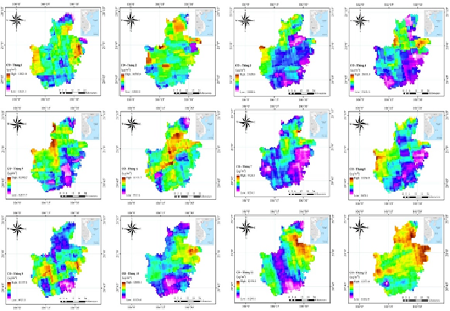
Hai Duong is a region with high economic and social development as well as urbanization. Due to its proximity to Quang Ninh province - the largest coal mining area in the country, air quality in Hai Duong undergoes complex changes, necessitating continuous monitoring and surveillance. This study presents the results of mapping the spatial distribution of air pollution parameters, including CO, NO2, and SO2, on a monthly and yearly basis in Hai Duong province using Sentinel 5P TROPOMI satellite data and the Google Earth Engine (GEE) cloud computing platform. The air pollutants concentration calculated from remote sensing data are compared with the limit values of basic air parameters in the Vietnamese National Technical Regulation on Air Quality (QCVN 05:2013/BTNMT). The obtained results in this study provide objective and timely information to assist local authorities in monitoring air quality in the region.
Downloads