
Application of Artificial Intelligence to monitor changes in land use in the Bac Tu Liem District area, Hanoi, during the period 2019-2023
Do Lan Phuong1*, Hoang Thi Thuy2, Do Nhu Hiep3
Keywords:
Abstract
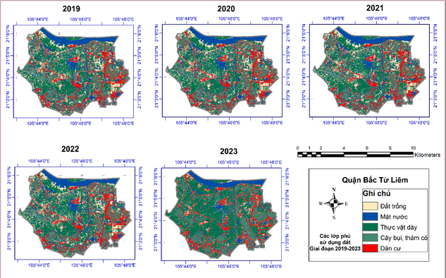
Artificial Intelligence is currently being applied with great effectiveness in various fields. There have been studies utilizing machine learning algorithms to classify land use, land cover from satellite images. This research employs AI with the Random Forest machine learning algorithm to classify, and monitor land use, land cover from Sentinel-2 images in the Bac Tu Liem District, Hanoi, during the period 2019-2023. The results of the study have indicated a decrease of 5.32% in the area covered by dense vegetation, while, conversely, the residential area has increased by 5.27% equivalent to 232.80 hectares after 5 years.
Downloads
Download data is not yet available.
Published
2025-01-01
Issue
Section
Bài viết
How to Cite
Application of Artificial Intelligence to monitor changes in land use in the Bac Tu Liem District area, Hanoi, during the period 2019-2023: Do Lan Phuong1*, Hoang Thi Thuy2, Do Nhu Hiep3. (2025). Magazine of Geodesy – Cartography, 10(01), 23-30. https://vjol.vista.gov.vn/tapchi-VUSTA/article/view/95680
